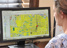
Mapping
Today’s energy operating environment demands rigorous analysis at every step. When strategic decisions can be made faster and more accurately than the competition, that’s powerful.
Mapping Examples
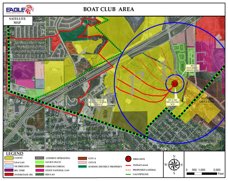
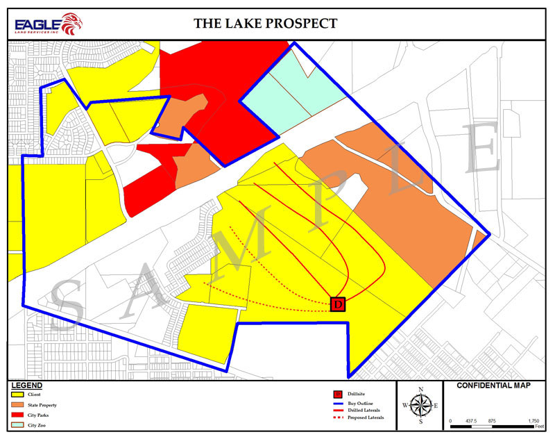
Eagle’s clients depend upon real-time access to real-time information to make critical operating decisions. Eagle’s in-house mapping team utilizes the most comprehensive suite of mapping applications available to prepare detailed leasehold or pipeline maps, and other customized maps upon request. All of our data and reporting is fully customizable to meet the needs of our clients and to fully integrate into their proprietary and out-of-box oil and gas software suites.
Eagle’s advanced systems seamlessly integrate database and reporting/map visuals. There are no gaps between maps and supporting data. Daily database updates allow important information to flow to our clients quickly and accurately. Multiple layers of information can be tied to tracts and reported upon through visual imaging and client-configurable reports. All data is presented in user-definable format, easily viewed without special applications.
Eagle’s data professionals stay current on new technology. They are highly trained and qualified to operate on dozens of different platforms. Eagle Land Services is committed to maintaining the highest standard in this area and continues to make significant investments in mapping equipment, software and ongoing education for data managers.
Reporting Examples
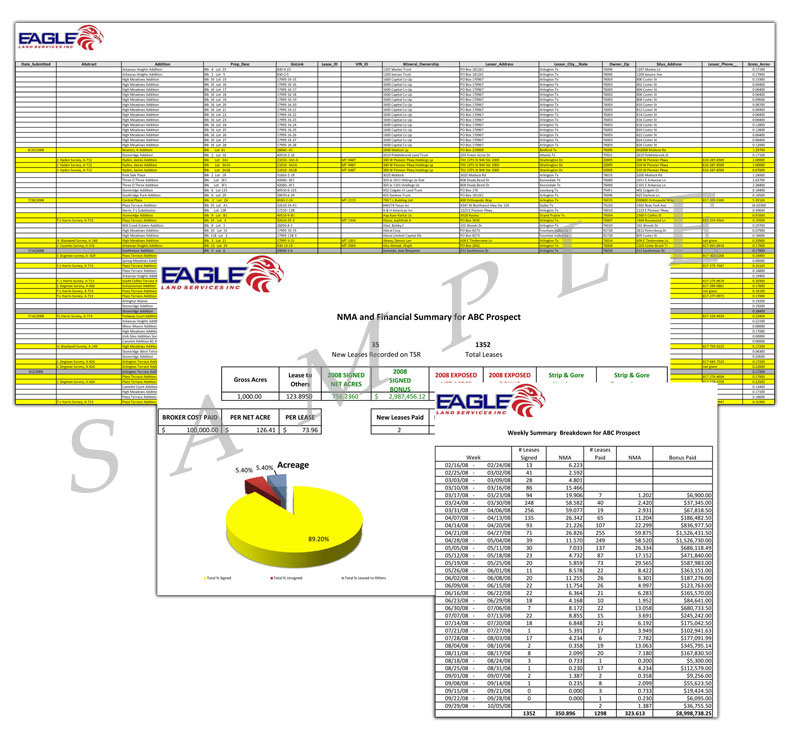
- Tract Status Reports allow the client to visualize progress for each prospect
- Financial Reports allow the client to track lease acquisition costs
- Statistical Reports give the client easy-to-read maps and data in graph or chart format